WELCOME
TO NOWHERE
This
is an excerpt from an East German (DDR) map of East Berlin from the
late 70s / early 80s, from the state cartographic publishing house "VEB
Landkartenverlag·Berlin"
Because of the Berlin Wall (here shown in purple) and the impossibility
for the E Germans to travel freely, including to the Western sectors of
Berlin (West Berlin), it was deemed preferable by the East German
authorities not to show at all any detail of West Berlin !.. What
is shown as a desert are of course densenly built-up areas, with an
equivalent density of streets, totally obliterated here, save for one or
two major streets linking with the border crossings (like Check Point
Charlie, on the lower edge of the border, shown under its official DDR
designation as "Grenzübergang Friedrichstrasse").
Even the spelling "Westberlin" in one word is DDR-fantasy, dictated by
political motives: the DDR regime perpetuated the fiction that there was
some kind of a third German state called "Westberlin". In the West, the
political entity made up of the three Western sectors was spelled "West
Berlin" or "West-Berlin", sometimes "Berlin (West)"; in the East, "East
Berlin" or "Ost-Berlin" in German was frowned by the regime, the
official designation was "Berlin - Hauptstadt der DDR", ie
"Berlin-Capital City of the GDR".

An aerial
view from 1984, roughly the same period as the map; the area south
of the Brandenburg Gate is the site of the new Holocaust Memorial,
inaugurated in May 2005.
By comparison, this how the area looks like today,
after complete removal of the Wall and rebuilding. 
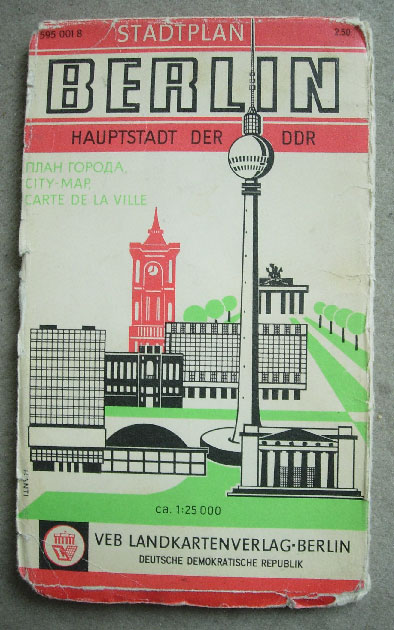
The cover of the map, typical DDR graphics, with leftover of pre-war
Bauhaus functionalism (?), it shows silhouettes of seven East Berlin
landmarks, including the Brandenburg Gate, which was located on the
border but technically 100%
on East Berlin territory. Price: 2.50 East German Marks